
North Texas on high alert for severe weather amid holiday rush
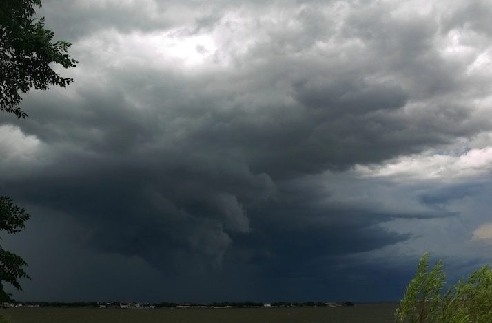
Dallas, Texas – North Texas residents are being alerted to brace for potentially severe weather conditions this Thursday. The National Weather Service (NWS) in Fort Worth has forecast a day marked by thunderstorms, with accompanying heavy rains, strong winds, and the possibility of isolated tornadoes, primarily from late morning through the afternoon.
The NWS has pinpointed the timing of the most intense weather activity between 10 a.m. and 4 p.m. Areas along the I-35 corridor, particularly around major cities such as Fort Worth, Dallas, and Waco, are highlighted as having an elevated risk. Alongside the threat of high winds and tornadoes, there is also a concern for hail and localized flooding, which could significantly disrupt travel.
Travelers planning to hit the roads for holiday destinations are advised to exercise caution, particularly in low-lying areas known for flooding. Staying updated through local weather forecasts and having multiple methods to receive weather alerts, such as NOAA weather radios or relevant smartphone apps, is recommended to navigate through the day safely.
Despite the tumultuous weather, the outlook improves significantly post-Thursday. The region is expected to see clearing skies by the evening, leading into a sunny weekend. Forecasters anticipate enjoyable weather on Friday, with sunny conditions continuing into Saturday and Sunday, where temperatures could reach highs near 70 degrees. However, motorists should be aware of potential morning fog on Friday, which could briefly reduce visibility.
Residents and visitors alike should stay vigilant and prepare for a swift change in weather conditions to ensure a safe and pleasant continuation of their holiday plans.